Commuting in North Texas: Getting Around Flower Mound, TX in 2026
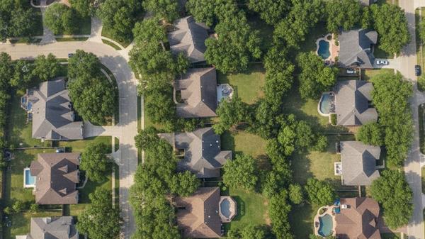
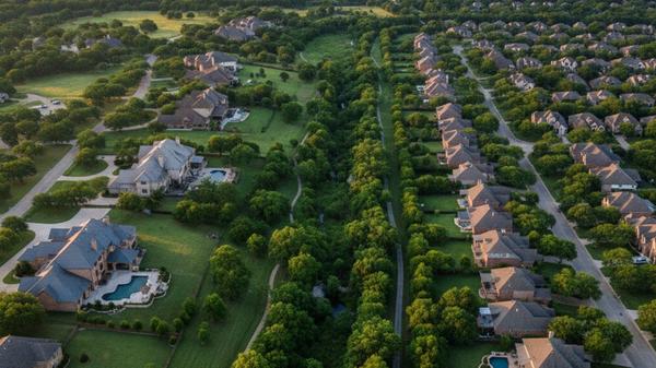
Flower Mound sits centrally between Dallas and Fort Worth, making it a popular base for commuters who work across the metroplex. The town covers over 40 square miles of Denton County, blending suburban neighborhoods with commercial centers and large parks. Most residents rely on personal vehicles to handle their daily errands and workplace commutes.
The local transportation network is built around a few major arteries that connect directly to regional highways. Drivers can usually reach the largest employment hubs in North Texas in under an hour during normal traffic conditions. Understanding the layout of these roads will help you plan your daily drives and choose the best neighborhood for your needs.
Primary Highways and Local Roads
Farm to Market Road 2499 serves as the main north-south artery running straight through the center of town. Also known as Long Prairie Road, this multi-lane street connects residential subdivisions to major shopping plazas and grocery stores. Most local trips will involve driving on a section of FM 2499 at some point.
For east-west travel, residents typically head south to access State Highway 121 or State Highway 114. These two toll roads provide fast routes into Dallas, Fort Worth, and neighboring suburbs like Grapevine and Southlake. Drivers willing to pay the toll rates can bypass many of the stoplights on local surface streets.
Interstate highways sit just outside the town borders for longer regional trips. Interstate 35E runs along the eastern edge of Lewisville, while Interstate 35W is accessible to the west near Argyle. Both interstates offer direct routes north toward Denton or south into the urban centers.
Typical Driving Times to Major Employment Centers
The Dallas-Fort Worth metroplex covers a massive geographic area, and traffic patterns shift throughout the day. Rush hour congestion on Interstate 35 and the local toll roads adds time to the morning and evening drives. Buyers should test their specific route during peak hours before committing to a neighborhood.
Driving from the center of town to the region's largest business districts involves a mix of local roads and highways. Assuming normal morning traffic, you can expect the following average commute times:
-
Downtown Dallas: Covering roughly 28 miles, this drive generally takes 35 to 45 minutes using SH 114 and I-35E.
-
Downtown Fort Worth: This trip is about 31 miles and takes 35 to 45 minutes via SH 121 and I-35W.
-
Las Colinas: The business district in Irving is closer, requiring a 20 to 30-minute drive down SH 114.
Residents working in nearby suburbs like Southlake or Grapevine have much shorter commutes. Those trips often take less than 15 minutes and rarely require highway driving.
Driving to DFW Airport and Dallas Love Field
Dallas Fort Worth International Airport sits just outside the town's southern border. Driving to the terminals takes only 15 to 25 minutes, depending on the exact terminal and security checkpoint you need. This proximity makes the area a popular choice for corporate travelers and airline employees.
Dallas Love Field offers another option for domestic flights, though it requires a longer drive into Dallas. The trip covers 24 to 32 miles and usually takes 35 to 45 minutes by car. Drivers typically take SH 114 east to Mockingbird Lane to reach the entrance.
Ride-sharing services like Uber and Lyft operate throughout the area for easy airport transfers. Local taxi companies also provide scheduled pickups for early morning flights. Using these services allows travelers to avoid daily parking fees at the airport garages.
Public Transit and Commuter Rail Access
The town operates as a car-dependent suburb and does not manage its own municipal bus system. Flower Mound is not a direct member of the Denton County Transportation Authority, meaning standard public transit routes do not run through local neighborhoods. Residents handle most of their daily transportation needs with a personal vehicle.
Commuters who prefer rail travel can drive to nearby DCTA A-train stations. The closest boarding platforms are located in neighboring Lewisville and Highland Village. The A-train runs north to Denton and south to Carrollton, where riders can transfer to the Dallas Area Rapid Transit system.
Specialized transit services are available for specific resident groups. SPAN Transit provides demand-response rides for seniors and individuals with disabilities throughout Denton County. Eligible riders can schedule trips for medical appointments, grocery shopping, and other daily tasks.
Using the Local Paved Trails and Bike Lanes
The town maintains an extensive network of paved multi-purpose trails designed for walking, running, and cycling. Over 50 miles of these paths connect residential neighborhoods to local parks, schools, and shopping centers. Cyclists often use these trails for weekend recreation and short trips around their subdivisions.
Several major local roads feature designated bike lanes for road cyclists. These lanes provide a buffer from vehicle traffic, though riders should remain cautious on busy streets like FM 2499. The town continues to expand its cycling infrastructure with each new road development project.
Mountain bikers and off-road cyclists frequently head to the trails surrounding Grapevine Lake. The Northshore Trail offers miles of rugged terrain winding through the woods along the water. This popular destination draws riders from all over North Texas for outdoor exercise.
Frequently Asked Questions
Does Flower Mound have public transportation?
The town does not operate a traditional public bus system or a municipal transit network. Residents can drive to neighboring Lewisville to access the DCTA A-train for commuter rail service. SPAN Transit also offers specialized ride services for local seniors and disabled residents.
How far is Flower Mound from DFW Airport?
Dallas Fort Worth International Airport is located about 10 to 12 miles south of the town center. The drive typically takes 15 to 25 minutes using FM 2499 and International Parkway. Ride-sharing apps offer a convenient alternative to long-term airport parking for this short trip.
Can you get around Flower Mound without a car?
Living here without a personal vehicle is challenging, as the suburban layout spaces out residential and commercial areas. While the 50 miles of paved trails support cycling for short errands, a car is necessary for most daily commutes and regional travel. Ride-sharing services can fill in the gaps for occasional trips.
Categories
Recent Posts